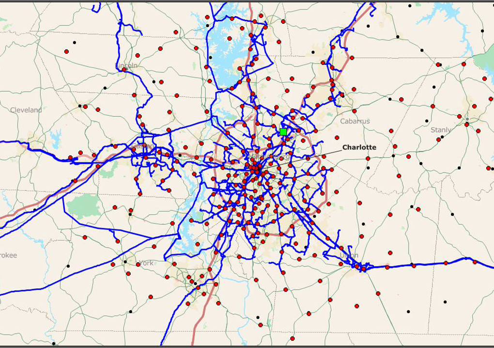
Application Areas--GIS Mapping
GIS Mapping for Telecommunications, Cellular Backhaul, Cellular Coverage, Wireless Coverage, eNodeB/BTS Location Determination, Optical Fiber Network Mapping, Business Case Analyses, Population Statistics, Public Safety, and Government.
Services
• Geographic Information Systems (GIS) Mapping for Telecommunications
• Custom GIS maps of population, income, employment, and other data
• Aerial, topo, elevation and LIDAR maps
• Maps of regional business data and statistics
• Maps of present and future customer locations with any other relevant data
• Land use information
• Tower and/or building location and height maps (we have databases of all towers and buildings used as wireless nodes in the US)
• Automated calculation of tower or building distance from fiber backhaul, microwave backhaul, POP’s, or other connection points
• Line-of-sight studies using terrain elevation and clutter data, including high-resolution LIDAR
• Frequency spectrum maps
• Spectrum ownership maps
Discussion
SpectraNet uses MapInfo for the most complicated and detailed mapping projects, especially where there is a need for automated calculations–for example, distance of buildings or towers from optical fiber connection points. In order to be compatible with non MapInfo users, we can export MapInfo data into Google Earth Pro to share key information.
For microwave point-to-point network designs or RF coverage analyses, we can export the microwave network links or coverage plots into high quality MapInfo or Google Earth Pro aerial and/or street maps. Furthermore, we have successfully used population statistics with RF coverage maps to estimate base-station node density requirements based on typical subscriber information, such as the percentage of mobile clients in a region that use a particular carrier, and further assuming certain data-demands during peak business hours.
For microwave point-to-point network designs or RF coverage analyses, we can export the microwave network links or coverage plots into high quality MapInfo or Google Earth Pro aerial and/or street maps. Furthermore, we have successfully used population statistics with RF coverage maps to estimate base-station node density requirements based on typical subscriber information, such as the percentage of mobile clients in a region that use a particular carrier, and further assuming certain data-demands during peak business hours.
